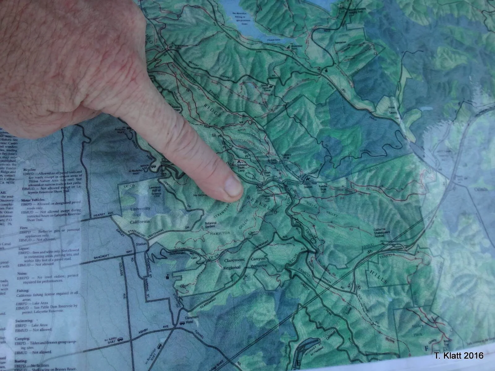
I learned of a wildfire on late afternoon of Thursday, June 30, 2016 on Grizzly Peak Blvd, in Oakland and responded to the scene ( I retired from UC the next day). This was at the northwest end of the inter-agency work-to-date managing the vegetation on Frowning Ridge overlooking Strawberry Canyon, about 2 miles to the north of Claremont Canyon. Luckily, the winds were very light and there was an overwhelming initial response from fire agencies.
Interestingly, the fire burned through EBMUD’s 4-acre “tower” hillside, across from UC signpost 15. The fire was largely confined to surface fuels (eucalyptus detritus) and did not engage the canopy, though it burned to the top of the hill. The EBMUD hillside is the only portion of Frowning Ridge not converted to native floral communities (Remove-Restore-Re Establish) since the HEF was formed. We have this same fuels condition on EBMUD land in Claremont Canyon as well. The hill has slopes of over 100% and burned only a few hundred feet from the PG&E high voltage lines feeding UC Berkeley and the Lab.
We have few opportunities to review ignitions in our fuel management project areas, and each fire improves our understanding of the risks and how management actions mitigate or exacerbate the fire behavior. The photo below shows the responders at the fire, the unburned fuel adjacent to that which burned, and a vista photo of the Frowning Ridge eucalyptus/Monterey pine remove work (UC, EBRPD, Oakland-WPAD, PG&E all partners). I think EBMUD needs to take a hard look at their eucalyptus groves along the ridge, as these are strategic weak links in both Strawberry and Claremont Canyons.